
A field director hands volunteers a walk list built from a ZIP lookup. The team expects every address to belong to one congressional district, so scripts, turf, and reporting are organized around that assumption. At the first boundary street, however, the list starts sending volunteers toward the wrong representative’s constituency. The problem isn’t a bad formula. It’s the belief that a postal area and a legislative boundary are interchangeable.
Introduction to Congressional District Mapping
ZIP codes for congressional districts look simple in a spreadsheet. A ZIP goes in one column, a district comes out in another, and a campaign can move straight to turf cutting. That workflow breaks when a ZIP Code Tabulation Area overlaps more than one district.
A canvassing team may receive one list for a ZIP and divide it among volunteers as if the entire area belongs to one representative. Some doors may sit in one district, while nearby addresses fall across the boundary. Volunteers lose time, residents receive the wrong script, and campaign reports record contacts against the wrong race.
The reliable approach starts with a clear distinction: a ZIP code is an approximate geographic filter, not a congressional-district boundary. The Census Bureau’s relationship data show that ZIP-to-district matching can be a many-to-many geographic problem, so serious field operations need address-level assignment whenever district accuracy matters.
Understanding ZIP Codes versus Congressional Districts
A USPS ZIP Code is designed around mail delivery. Its boundaries reflect delivery routes, service areas, and operational needs, not the legal lines used to elect members of Congress. Congressional districts, by contrast, are legislative geographies drawn under state redistricting plans and tied to population-based representation.
The Census Bureau’s ZCTAs add another layer. A ZCTA is a statistical approximation created by assigning each census tabulation block the ZIP code most frequently associated with addresses in that block, then grouping blocks that share the same predominant ZIP code. That construction supports consistent demographic analysis, but it doesn’t reproduce every USPS delivery boundary.
This distinction matters because a campaign database often contains a postal ZIP, while a district assignment requires a spatial relationship to an authoritative boundary. A ZIP can overlap several districts, and a district can include portions of multiple ZIP areas. A ZIP-only lookup therefore provides a useful first-pass filter, but it doesn’t prove which district contains a specific address.
Campaign teams should also keep postal and census geography separate in their data model. A voter file may use USPS delivery information, while demographic enrichment may use ZCTAs and district analysis may use Census GEOIDs or FIPS-based identifiers. The distinction is closely related to the broader difference between voter files and census data described in this campaign data guide.
The practical rule is straightforward:
- ZIP code: useful for approximate filtering, aggregation, and initial list discovery.
- ZCTA: useful for statistical analysis, with known differences from postal delivery areas.
- Congressional district: the political geography used for representation and race-specific targeting.
- Address point: the preferred basis for assigning an individual record to a district.
Navigating Census Bureau Relationship Files
The Census Bureau’s relationship file is a strong starting point for understanding how ZIP areas and congressional districts intersect. It links a state, a five-digit ZCTA, and a congressional-district identifier in a standardized national file. The important detail is that the file can contain more than one record for the same ZCTA.
A campaign analyst should handle the file as a relationship table, not as a lookup table that forces one answer. The workflow is:
- Preserve the ZCTA as text. Leading zeroes matter, and numeric conversion can corrupt geographic identifiers.
- Group records by state and ZCTA. Multiple rows for one ZCTA should remain visible rather than being collapsed.
- Return every linked district. A split ZCTA should produce a list of possible districts or a split flag.
- Use the result for estimation. Do not convert geographic overlap into person-level assignment.
- Escalate precise cases. Send voter addresses through geocoding and a boundary join before producing final walk lists.
The national file provides concrete examples of this structure. Alabama ZCTA 35005 appears with Congressional District 06 and Congressional District 07. Arizona ZCTA 85008 appears with District 07 and District 09, while ZCTA 85281 appears with District 07 in the cited relationship file.
| State | ZCTA | Congressional Districts |
|---|---|---|
| Alabama | 35005 | 06, 07 |
| Arizona | 85008 | 07, 09 |
| Arizona | 85281 | 07 |
These rows describe geographic overlap, not a conclusion that every address in the ZCTA belongs to every listed district. The Census relationship file is valuable because it exposes ambiguity that a one-row-per-ZIP table hides. Campaign staff should retain all linked districts, mark the ZIP as split, and avoid assigning a representative until the address has been located more precisely.
For broader context, the Census Bureau’s official national ZCTA-to-congressional-district relationship file is the relevant reference for interpreting these relationships.
Evaluating Lookup Methods for Accuracy
A ZIP-only lookup is fast and inexpensive, but its output is approximate. It works well when a campaign needs a broad geographic estimate, a preliminary audience filter, or an early inventory of potentially relevant districts. It fails when staff treat its first returned district as the definitive assignment for every voter in that ZIP.
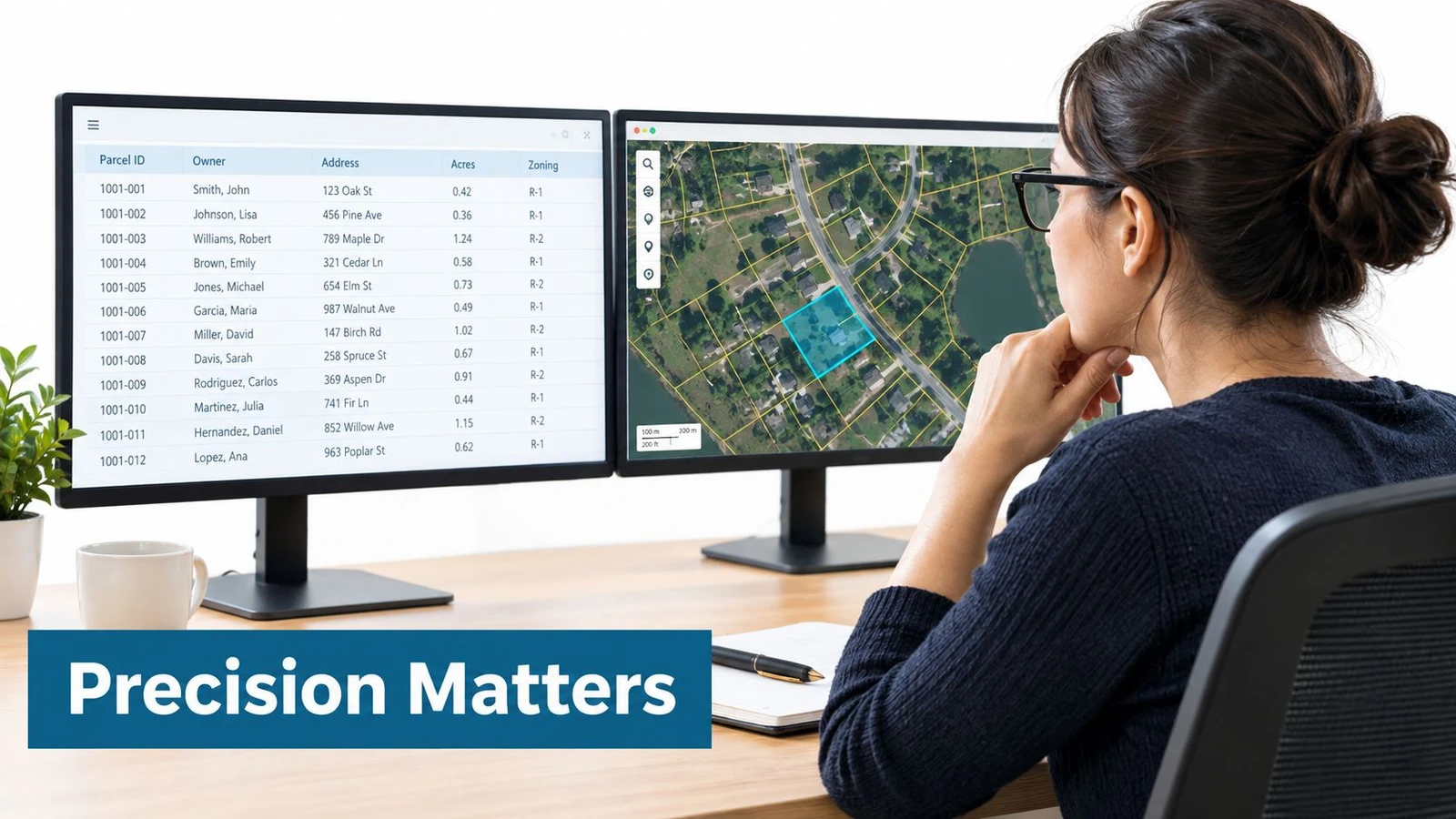
Address-level geocoding followed by a point-in-polygon join is more demanding, yet it matches the operational question more closely: which district contains this address point? The process uses a district boundary layer, converts each address into geographic coordinates, and tests the point against the relevant polygon. Edge addresses can then be reviewed instead of assigned automatically.
| Method | Useful for | Main risk |
|---|---|---|
| ZIP-only lookup | Discovery and rough aggregation | Assigns one district where several may apply |
| ZCTA crosswalk | Identifying possible overlaps | Describes area relationships, not every address |
| Address geocoding | Locating individual records | Depends on address quality and geocoding precision |
| Point-in-polygon join | Final district assignment | Requires current authoritative boundaries |
The operational consequences are tangible. A wrong assignment can place a voter on the wrong walk list, attach an unsuitable script, distort district-level contact totals, and send volunteers to doors that don’t belong in the current program. A crosswalk can help prioritize review, but it shouldn’t be the final authority for person-level targeting.
Practical rule: Use ZIP relationships to find uncertainty, then use address geography to resolve it.
Teams should preserve failed and low-precision geocodes for review. Apartment-heavy addresses, incomplete street information, and rural or unusual delivery records deserve a queue rather than an automatic district label. Precision is less about finding a clever lookup formula and more about refusing to hide uncertainty.
Impact of Redistricting on Data Currency
A district assignment is valid only within a defined boundary vintage. Census reference materials describe congressional districts for particular Congress periods, and the Census Bureau provides separate files for earlier configurations. A table built for the 116th Congress, covering January 2019 through January 2021, shouldn’t be applied automatically to the 119th Congress, covering January 2024 through January 2026 in the cited reference materials, because district plans can change after reapportionment or state redistricting. See the Census Bureau’s congressional district reference files for the relevant vintage information.
The ZCTA side of the join has its own timestamp. Current materials describe ZCTAs based on 2020 Census tabulation blocks, while district boundaries reflect a congressional plan. A postal ZIP may look unchanged to campaign staff even as the district boundary crossing that area has changed.
Every production assignment should therefore carry metadata:
- Congress and plan: identifies the political boundary version.
- ZCTA vintage: identifies the statistical geography used in any crosswalk.
- Source date: records when the data entered the system.
- Assignment method: distinguishes ZIP estimation from address-based assignment.
Historical reporting needs the same discipline. If a campaign compares contact totals across cycles without recording the boundary vintage, staff may mistake a geography change for a field-performance change. Rebuilding assignments from the original address data and a new boundary layer is safer than editing old district labels by hand.
Best Practices for Precise Voter Targeting
A canvassing list can place neighboring addresses in different congressional districts while assigning the same postal ZIP to both. Field teams should therefore use authoritative district geometry as the reference layer, then treat ZIP-based crosswalks as estimates for early targeting. Census TIGER/Line files support point-in-polygon assignment, while crosswalks help identify areas that require closer review.
The 2024 TIGER/Line vintage represents the 119th Congressional District plans submitted by states. Those boundaries became effective January 3, 2025, for the 119th Congress, scheduled to run through January 3, 2027, according to the Census Bureau’s 2024 TIGER/Line congressional district file guidance. Keep 118th and 119th Congress assignments in separate datasets.
Review the records most likely to produce a false match:
- Boundary edges: check geocoded points near district lines instead of assigning an entire ZIP uniformly.
- Split ZIPs: retain every plausible district relationship until address-level evidence resolves it.
- Apartment-heavy ZIPs: verify unit-level details. A building’s ZIP does not establish every resident’s district.
- Military addresses: inspect special formats and geocoding results manually.
- Incomplete records: route entries lacking adequate location precision for remediation.
- Undefined areas: preserve the source code rather than forcing a district label.
District identifiers need state context. Store the state FIPS, district FIPS, boundary vintage, and assignment method together. For unresolved records, hold the assignment and send them for review. A smaller, qualified list is more useful to volunteers than a larger list built on confident errors.
Implementing District Assignment Workflows
A reliable workflow separates raw voter data, geographic processing, and final campaign outputs. The original address should remain untouched, while normalized fields and assignment results are stored alongside it. This makes the process auditable and allows staff to regenerate assignments after a boundary update.
A practical record schema includes:
- Source address: the exact value received from the voter file.
- Normalized address: the standardized form used for geocoding.
- ZIP and ZCTA: retained separately when both are available.
- Latitude and longitude: accompanied by geocoding precision.
- State FIPS and district FIPS: the normalized political identifiers.
- Boundary vintage: the Congress and source file used.
- Assignment method: crosswalk, geocode, or point-in-polygon.
- Review status: accepted, flagged, unresolved, or manually verified.

The processing sequence should be deterministic:
- Normalize and validate the address.
- Geocode the record and store precision.
- Load the selected district vintage.
- Run the point-in-polygon join.
- Flag edge cases and missing matches.
- Export campaign lists only after validation.
- Preserve the input version and processing metadata.
A database or data pipeline should reject silent overwrites. If a new district vintage changes an assignment, the system should create a new version rather than erase the prior result. Teams responsible for broader campaign data practices can also consult this campaign data management resource.
Areas without a defined congressional district need explicit handling. Census-derived datasets may use “ZZ” for such areas, so the workflow should preserve that value and route it for review rather than substituting a nearby district.
Leveraging Technology for Field Operations
The final challenge is translating a correct polygon into a usable walking plan. A field director doesn’t hand volunteers a boundary file and expect them to interpret it at the curb. The system has to turn verified voter points into road-aware, balanced turf while preserving the district filter that produced the list.
A modern canvassing workflow can begin with a current voter source, match records to addresses, and geocode them before route creation. Staff can then define a district or custom polygon, generate routes inside that geography, and monitor progress as volunteers work. The valuable feature isn’t a colorful map by itself. It’s the connection between geographic validation, turf construction, mobile execution, and reporting.
That connection also reduces manual handoffs. When staff repeatedly export CSV files, clean them, re-upload them, and rebuild routes, each transfer creates another opportunity to lose a district field or mix boundary vintages. Integrated voter matching and geocoding keep the assignment context attached to the record.
For campaign teams evaluating mobile field systems, this political campaign app guide provides useful context on the operational capabilities to look for. The key requirements are offline data capture, route visibility, polygon-based targeting, and a clear audit trail from source voter record to completed contact.
A field director should be able to answer three questions during a shift: which district produced this turf, which boundary version was used, and whether the volunteer’s completed contacts remain inside the intended geography. If the platform can’t answer those questions, route convenience is masking a data problem.
Ensuring Operational Data Integrity
Geographic accuracy is maintained across the entire lifecycle, not at the moment a staff member downloads a ZIP lookup. The source record, geocoding result, boundary file, assignment method, route, and field outcome all need to remain connected.
That requires three controls working together. Spatial control assigns addresses against current district polygons. Temporal control stores the Congress and source date. Operational control prevents field teams from receiving records that haven’t passed the required review state.
A useful handoff sequence looks like this:
- Research: identify possible districts with a crosswalk, while retaining every possible match.
- Resolution: geocode addresses and perform the boundary join.
- Validation: review low-precision points, edges, and undefined areas.
- Turfing: generate routes only from approved assignments.
- Reporting: aggregate contacts by the same district vintage used for targeting.
- Reprocessing: rerun assignments from preserved source addresses when boundaries change.
This structure makes errors visible. If a report contains contacts from two district vintages, the metadata exposes the mismatch. If a ZIP-only list enters the system, the assignment method shows that it was estimated rather than address-resolved.
A district label without a source date and method is an opinion with a database field attached.
The discipline also improves accountability. Campaign managers can trace an incorrect assignment to an address, a geocoder result, a boundary file, or a processing rule instead of asking volunteers to explain a map error they didn’t create.
Addressing Common Geographic Assumptions
The most persistent mistake is assuming that every address in a ZIP belongs to one congressional district. The Census relationship data contradict that assumption by listing multiple district relationships for individual ZCTAs, including Alabama 35005 and Arizona 85008. Those relationships identify overlap, not a definitive representative for every household.
Another mistake is treating a static table as permanent. District plans change, ZCTA definitions are statistical approximations, and different matching methodologies can produce different results. The Congressional Research Service warning cited in the Census reference materials reinforces the practical point that five-digit ZIP matches aren’t definitive.
A campaign should challenge any lookup that:
- returns only one district for every ZIP without a split flag;
- hides the boundary vintage;
- provides no assignment method;
- cannot expose the underlying address or point;
- replaces missing geography with a nearby district.
The right response to ambiguity isn’t to discard ZIP data. It’s to use the data faithfully. ZIP relationships can identify where a campaign needs deeper resolution, prioritize list cleaning, and support broad aggregation. They shouldn’t be used to tell a volunteer which congressional script belongs at a specific door.
The same principle applies to other location-based systems. Teams working with geographic targeting concepts outside elections may find this guide to location-based OTA delivery useful for its focus on location precision and boundary-aware delivery.
Quick Reference for Campaign Teams
Before publishing a congressional canvassing list, staff should confirm the following:
- Separate ZIP from district: Store postal ZIP, ZCTA, and congressional district as different fields.
- Expose split areas: Keep every district linked to a ZCTA and flag many-to-many relationships.
- Resolve addresses: Use geocoding and a point-in-polygon join for person-level targeting.
- Version boundaries: Record the Congress, district plan, ZCTA vintage, and source date.
- Normalize identifiers: Store state FIPS with the district FIPS code.
- Review difficult records: Check edge addresses, apartments, military formats, and unresolved geocodes.
- Preserve history: Create new assignment versions instead of overwriting prior results.
- Audit outputs: Confirm that routes, scripts, and reports use the same district vintage.
A ZIP lookup is a starting point. It becomes operationally trustworthy only after the campaign identifies ambiguity, resolves individual addresses, and records how each district label was produced.
Conclusion on Effective District Mapping
Accurate ZIP codes for congressional districts work begins with refusing a convenient fiction. ZIP codes and congressional districts serve different purposes, and their boundaries can overlap in ways that a one-row lookup conceals.
Crosswalks remain useful for discovery and broad analysis. Professional field operations require more: current district geometry, address-level geocoding, explicit split-area handling, and metadata that makes every assignment reproducible. That combination keeps volunteers on the right turf, aligns scripts with the correct race, and makes contact reports defensible.
Campaign teams that build this discipline before route creation avoid turning geographic uncertainty into field confusion. The strongest process doesn’t pretend the map is simple. It makes the complexity visible, resolves it at the address level, and gives staff a clear record of why every voter entered a particular district list.
doornoc combines voter data services, address matching, geocoding, polygon-based turfing, route planning, offline canvassing, and real-time field reporting for campaign teams. Visit doornoc to build district-aware canvassing workflows that keep messy geography out of volunteer walk lists.
Looking for a tool to run this? doornoc’s canvassing software bundles voter data, automatic turf cutting, the mobile app, and live reporting in one platform.