A canvassing shift can look perfect on a desktop screen and still collapse at the first rail line. Volunteers reach a dead end, lose cellular service, discover that half the walk list sits behind an impassable boundary, and start making manual decisions with incomplete data. By the end of the shift, the team has walked less, recorded inconsistently, and learned not to trust the route.
A route planning app for political and advocacy teams must solve field friction, not merely draw an efficient line between addresses. Offline access, pedestrian accuracy, rail and river awareness, balanced turf, and dependable synchronization matter more than polished dashboards or impressive optimization language.
| Field requirement | What teams should verify | Why it matters |
|---|---|---|
| Walkability | Pedestrian paths, entrances, sidewalks, and barriers | Door lists must reflect how volunteers actually move |
| Boundary awareness | Rail crossings, rivers, restricted roads, and disconnected streets | A short map distance can become an impossible field route |
| Offline operation | Downloaded maps, voter data, and local recording | Volunteers must keep working when coverage disappears |
| Balanced turf | Comparable effort, not just comparable address counts | Uneven routes create frustration and unreliable shift reporting |
| Mobile sync | Automatic queuing and conflict handling | Field data must reach campaign staff without manual reconstruction |
The High Cost of Bad Routes in the Field
The failure usually begins before the team leaves. A field director opens a desktop map, draws a boundary, and accepts a route that appears compact. Volunteers receive addresses in a neat sequence, collect clipboards or phones, and head into the neighborhood expecting a routine shift.
The first group reaches a rail corridor. The map shows homes on the other side, but the nearest legal crossing is far away. A second group follows a road that looks direct on the screen and finds a river, a fenced service area, or a slope that makes the walking route impractical. Another volunteer enters a weak-coverage zone and watches the list stop loading. The team starts taking screenshots, guessing at addresses, and writing notes that may never reconcile with the central database.

The operational damage goes beyond wasted minutes
A bad route doesn’t just slow a volunteer. It changes behavior.
- Safety declines: People cross where they shouldn’t, walk along unsuitable roads, or enter unfamiliar areas to recover time.
- Volunteer confidence drops: Volunteers blame themselves for route failures that the planning process caused.
- Coverage becomes uneven: One team finishes early while another receives an impossible walk list.
- Data integrity suffers: Manual notes, skipped doors, duplicate contacts, and delayed uploads weaken campaign reporting.
- Field directors lose visibility: A dashboard can show activity without explaining whether the assigned route was physically workable.
General navigation products are designed for broad travel. They may prioritize driving speed, the shortest apparent path, or a known road network. Door-to-door operations need a different model. The route must represent the actual pedestrian journey between reachable entrances, not merely the geographic relationship between address points.
Field rule: If a route hasn’t been tested against barriers and signal loss, it isn’t ready for volunteers.
The right question is operational
Campaign teams shouldn’t ask whether an app can optimize stops. They should ask whether it can prevent a volunteer from receiving a list that looks balanced but demands twice the effort of another list.
The strongest evaluation starts with the map data, then tests the mobile workflow in the neighborhoods where the campaign will operate. A dedicated route planning app earns its place by protecting the shift from predictable failures, especially poor connectivity, broken pedestrian links, and boundaries that split a community in practice.
Core Criteria for Field Team Routing
Good routing for field teams starts with four practical tests. A route must be walkable, aware of physical barriers, responsive on field devices, and usable without a live connection. A visually attractive map that fails any of these tests creates operational risk.
Walkability must describe movement, not proximity
Address points can sit close together while remaining difficult to reach on foot. A strong system distinguishes roads from footpaths and respects the entrances, crossings, and connected paths that determine the actual walking sequence.
For canvassing, the route should also account for effort distribution. Equal address counts don’t produce equal shifts when one list includes steep terrain, long blocks, apartment access problems, or barriers that force detours. Route labels should help field directors see whether a turf is easy, moderate, or demanding.
Physical barriers need first-class treatment
Rail lines, rivers, highways, fences, and restricted areas divide neighborhoods in ways a simple radius won’t capture. The route engine should use map attributes that identify legitimate crossings and avoid treating a barrier as an inconvenience that volunteers can solve themselves.
OpenStreetMap-based routing is especially useful when local path and barrier information is maintained accurately. Independent benchmarking found a route in every one of 250 generated routes, while also warning that data gaps and outdated attributes can distort results in some regions. The practical lesson is clear: open data can support global routing, but campaign teams still need local validation before deployment. Independent OpenStreetMap routing benchmarking provides that useful caution.
Mobile performance and offline access are inseparable
A volunteer’s phone may be older, low on storage, or operating under poor coverage. The interface should load the assigned list quickly, keep the map usable, and save interactions locally instead of treating connectivity as a permanent assumption.
Preprocessing can make a substantial difference. In an academic benchmark, short one-to-many queries fell from about 400 milliseconds to 260 milliseconds, with first results arriving in 140 milliseconds. Over longer distances, a 50-kilometre journey dropped from 7 minutes to 10 seconds, while a 100-kilometre journey dropped from 56 minutes to 21 seconds. Downloaded map data also fell from 30 MB to 3 MB and from 170 MB to 9 MB, respectively, after preprocessing. The academic OpenStreetMap routing benchmark shows why preprocessing isn’t a technical luxury for field operations.
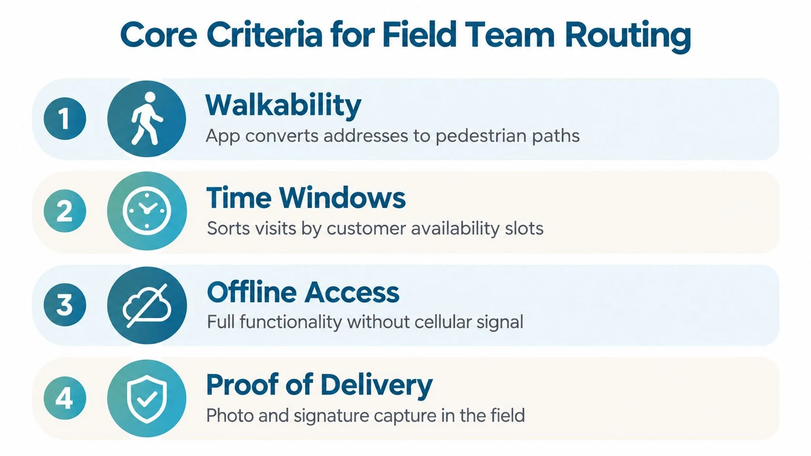
A field-ready system should pass a simple test: the volunteer can open the assigned turf, move between doors, record an interaction, and continue working after the network disappears.
Comparing Top Route Planning Contenders
The market contains two broad categories. General-purpose mapping products handle ordinary navigation well, while specialized field systems connect route generation with turf assignment, mobile data capture, and campaign oversight. The decision should be based on failure prevention, not the length of a feature page.
| Capability | General navigation category | Specialized canvassing category | Decision standard |
|---|---|---|---|
| OSM integration | May be hidden or unavailable for operational review | Can use detailed pedestrian and barrier data | Teams should inspect the underlying map logic |
| Offline depth | Often limited to map viewing or basic navigation | Should include turf, voter data, and interaction capture | Offline must preserve the whole field workflow |
| Terrain intelligence | Usually optimized for common travel modes | Can account for roads, rails, rivers, and walking effort | The route must reflect field reality |
| Mobile synchronization | Built around personal navigation | Built around team assignment and campaign records | Local updates need reliable queuing and conflict handling |
| Turf balance | May group nearby locations | Can divide a boundary by practical effort | Address counts alone aren’t enough |
A generalist map can be adequate for a staff member traveling to a single meeting. It becomes unreliable when a campaign assigns hundreds of doors across divided neighborhoods and expects volunteers to work without interruption. The failure isn’t always obvious in advance. A route may avoid a major barrier but still create an uneven list because it ignores walking effort, building access, or the distance between valid crossings.
What specialized routing should expose
A campaign manager should be able to draw a geography, inspect the resulting territories, and identify why one route is harder than another. Auto Turf and Polygon Route capabilities illustrate the right direction. A system such as doornoc can generate balanced, effort-labeled, road-bounded routes and let teams define custom boundaries before matching voters inside them.
The route is only half the product. The mobile app must deliver the assigned list, preserve records offline, and synchronize updates when service returns. The operations dashboard should show completion and activity clearly enough for a field director to reassign work during the same shift.
The blunt recommendation
For simple travel logistics, a general navigation category may be sufficient. For political canvassing, advocacy work, or any door-to-door program divided by real-world barriers, a specialized platform is the safer choice.
Teams evaluating options should test the same difficult neighborhood in each system. Include a rail corridor, a river, a weak-coverage area, and a boundary that produces uneven walking distances. The winner is the tool that gives volunteers a workable shift and gives staff a trustworthy record afterward. A practical overview of the operational model is available in field operations software guidance.
Implementing Offline-First Workflows
Offline mode only helps when teams prepare it deliberately. A field director shouldn’t discover during a shift that the app downloaded a background map but not the voter list, or that interaction records remain trapped on a device after the volunteer returns.
Prepare each zone before departure
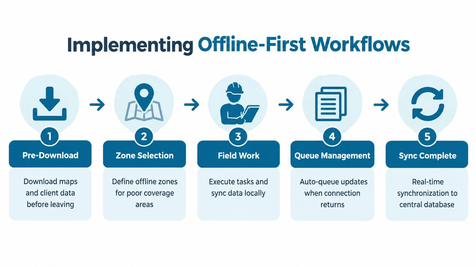
The first step is to define the areas where signal loss is likely. Download the map tiles, assigned turf, contact records, survey configuration, and any field instructions while the device has a stable connection.
Then test the package in airplane mode. The test should answer practical questions:
- Can the volunteer open the assigned route?
- Can the app move from one door to the next?
- Can the volunteer view the relevant record?
- Can the volunteer save an interaction without service?
- Does the update queue for later synchronization?
A route that fails any answer needs correction before the team leaves. Field directors should also check available storage, battery levels, device permissions, and the freshness of the downloaded data.
Train volunteers around the offline state
Volunteers shouldn’t need to understand synchronization architecture. They do need a clear procedure. The app should make locally saved activity visible, explain when updates are waiting, and avoid presenting a blank screen as if work has disappeared.
Practical rule: Every offline test should include one complete interaction, not just a map-opening test.
When connectivity returns, the system should upload queued records automatically or give the user an unmistakable sync action. Staff should review exceptions, duplicate records, and conflicts rather than assuming every device reconciled perfectly.
Use a repeatable pre-shift check
A reliable workflow has three checkpoints. Before the briefing, staff confirm that maps and data are current. At the briefing, team leads verify that every volunteer can open the assigned turf and understand the offline indicator. After the shift, staff confirm synchronization and investigate missing or conflicting records.
Campaign managers looking for a more detailed election-focused checklist can use offline canvassing app features for 2026 elections. The central principle remains simple: offline functionality must be rehearsed under offline conditions.
Real-World Scenarios and Use Cases
A route planning app proves its value in the awkward places. Clean suburban grids rarely expose the difference between a geographic route and a field-ready route. Divided neighborhoods, rural dead zones, and mixed vehicle teams expose it immediately.
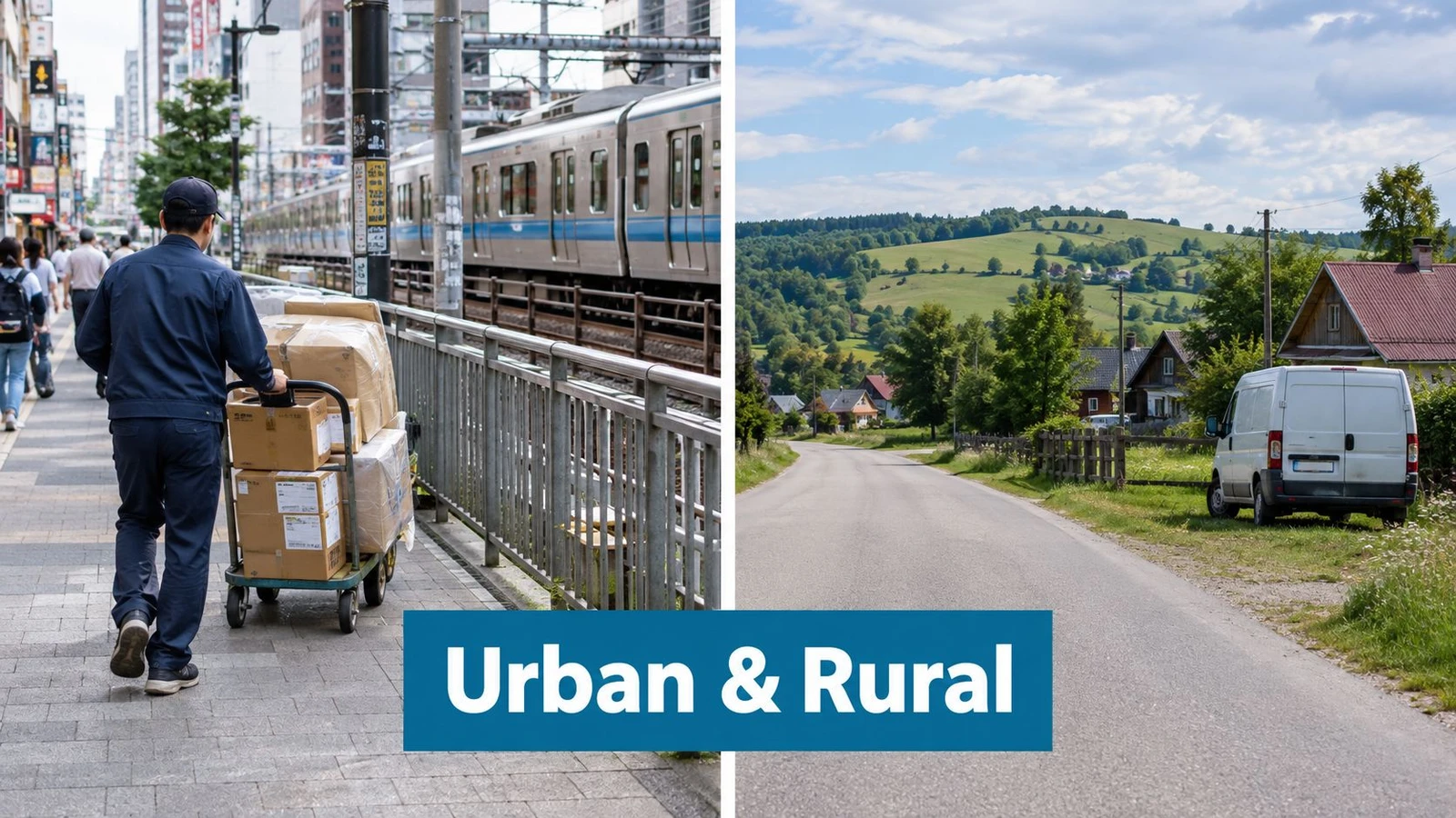
Dense urban canvassing
A city team receives a compact block of doors split by rail tracks. The addresses are geographically close, but the legal crossing sits several blocks away. A route that assigns doors by simple proximity gives one volunteer the easy side and another the difficult detour.
The better approach draws the campaign boundary first, then creates routes that account for crossings and walking effort. Balanced, effort-labeled routes help staff avoid assigning the same number of addresses to people facing very different physical workloads. That distinction matters during short shifts, when one bad crossing can consume the time needed for several conversations.
Rural programs with weak coverage
A rural advocacy team may cover scattered homes across long roads and patchy service. Volunteers need the full list and map stored locally before departure. They also need a recording workflow that doesn’t force them to wait beside a roadside for a connection.
The correct setup divides the geography into offline zones, validates the route in advance, and queues every interaction locally. Staff can then focus on outreach rather than asking volunteers to improvise around a blank map or reconstruct conversations from memory.
Multi-vehicle logistics
A logistics operation adds different constraints. Drivers need road-appropriate routes, clear stop sequences, and dependable status updates. A vehicle route that sends a driver toward a restricted road or an unsuitable crossing creates delays that affect every later stop.
For these teams, route planning should combine road restrictions, vehicle suitability, stop requirements, and live progress. The field director needs enough visibility to reassign work when conditions change, but the driver still needs a simple mobile experience that works when coverage is inconsistent.
The common operating principle
Each scenario rewards the same discipline: route from verified access, not from address proximity. The app must preserve the route and the record when the network, map assumptions, or original plan fails.
The Business Case for Specialized Routing
Free navigation tools appear inexpensive because their cost sits outside the software invoice. Campaigns pay elsewhere, through volunteer time lost to detours, staff hours spent repairing lists, missed contacts, and records that arrive late or incomplete.
The commercial category reflects how widely organizations now treat routing as operational infrastructure. One market estimate places route planning and optimization software at roughly USD 8.29 billion in 2025, with a projection of USD 24.28 billion by 2034. Another estimates USD 8.98 billion in 2026 and USD 16.78 billion by 2031, while identifying North America as the largest market and Asia Pacific as the fastest-growing region. These are projections and estimates, not guarantees, but they show that routing has moved beyond a niche utility. The route optimization software market overview provides the underlying estimates.
Consumer navigation has also normalized map-based routing at massive scale. Google Maps reportedly surpassed 2 billion active users worldwide in 2026, while Route4Me reports that its app has optimized more than 3 billion miles, supported 750 million stops visited, and planned 30 million routes. The market research summary on route optimization usage contains those reported milestones.
For political teams, the recommendation is direct. Pay for operational certainty where bad routing threatens safety, retention, and data quality. A specialized route planning app is justified when it combines barrier-aware turf creation, offline-first capture, and live campaign oversight. Teams should measure the investment against recovered field capacity and cleaner records, not against the price of a free map.
Campaign managers can connect routing decisions to outcome tracking through canvassing ROI measurement guidance.
Final Recommendations and Selection Checklist
The selection decision can be kept simple.
| Operational need | Recommended direction |
|---|---|
| Political canvassing with weak coverage | Choose an offline-first canvassing platform |
| Rail, river, or highway divisions | Choose routing with explicit barrier awareness |
| Uneven urban walk lists | Choose balanced, effort-labeled turf generation |
| Basic point-to-point logistics | A simpler routing category may be enough |
| Large field programs | Require mobile sync, live oversight, and scalable data workflows |
Before signing up, the field director should verify these must-haves:
- Pedestrian routing: The system distinguishes walkable paths from roads and respects valid crossings.
- Offline maps and records: Volunteers can open turf, view data, record interactions, and continue without service.
- Balanced assignment: Routes reflect practical effort rather than address count alone.
- Automatic synchronization: Local updates queue safely and reconcile after reconnection.
- Operational visibility: Staff can see progress and respond during the shift.
- Boundary control: Teams can define custom geographies and keep routes inside them.
Nice-to-have features include richer analytics, automated briefings, advanced integrations, and configurable reporting. They shouldn’t outrank the basics.
A field director should test one difficult neighborhood before committing. If volunteers can complete a full offline route without crossing an unsafe barrier or losing their records, the app has passed the test that matters.
doornoc combines mobile door-knocking, offline data collection, balanced turf generation, route monitoring, and campaign operations tools for political and advocacy teams. Visit doornoc to evaluate a field workflow built around reliable walking routes and resilient data capture.
Looking for a tool to run this? doornoc’s canvassing software bundles voter data, automatic turf cutting, the mobile app, and live reporting in one platform.